The name Møre og Romsdal was created in 1936; the first element refers to the districts of Nordmøre and Sunnmøre, and the last element refers to Romsdal. Until 1919, the county was called "Romsdalens amt", and from 1919-1935 "Møre fylke".
For hundreds of years (1660-1919), the region was called Romsdalen amt, after the Romsdalen valley in the present-day Rauma Municipality. The Old Norse form of the name was Raumsdalr; the first element is the genitive case of a name Raumr derived from the name of the river Rauma, i.e. "the dale of Rauma". Raumr may refer to stream or current, or to booming or thundering waterfalls like Sletta waterfall. The name may also refer to Raum the Old, one of the sons of Nór, the eponymous Saga King of Norway. Since the majority of the residents of the county lived in the Sunnmøre region, there was some controversy over the name. In 1919, many of the old county names were changed and this county was renamed Møre fylke.
The name Møre was chosen to represent the region where the majority of the county residents lived; that name is dative of Old Norse: Mærr and it is probably derived from the word marr referring to something wet like bog (common along the outer coast) or the sea itself. The name is interpreted as "coastland" or "bogland". Møre was originally the name of the coastal area from Stad and north including most of Fosen. (There is also a coastal district in Sweden that has the same name: Möre.) The change in name from Romsdalen to Møre was controversial and it did not sit well with the residents of the Romsdal region. Finally in 1936, the name was changed again to a compromise name: Møre og Romsdal (English: Møre and Romsdal).
The ambiguous designation møring - "person from Møre" - is used strictly about people from Nordmøre (and less frequently for people from Sunnmøre), excluding the people from Romsdal (while, consequently, romsdaling - "person from Romsdal" - is used about the latter).
Coat of arms
The coat of arms was granted on 15 March 1978; it shows three gold-colored Viking ships on a blue background. Shipping and shipbuilding were historically very important to the region, so boats were chosen as the symbol on the arms; the masts on the Viking ships form crosses, which symbolize the strong Christian and religious beliefs as well as the strong religious organisations in the county. There are three boats to represent the three districts of the county: Sunnmøre, Romsdal and Nordmøre.
 |
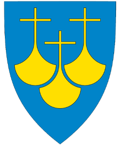 |
| Møre og Romsdal Flag | Møre og Romsdal Coat of Arms (Azure, three longships or) |
Geography
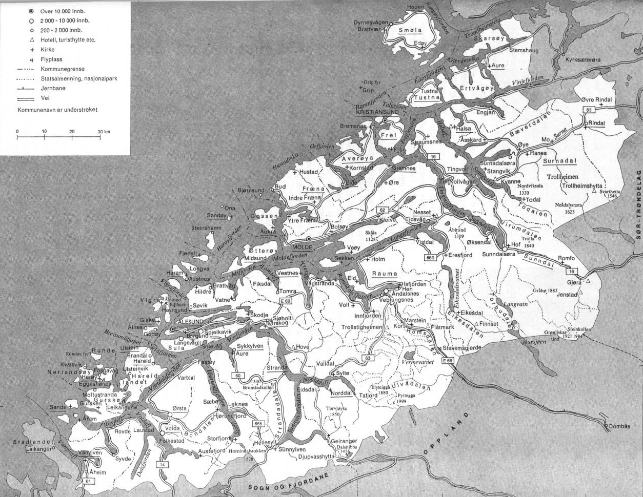
Traditionally, the county has been divided into three districts. From north to south, these are Nordmøre, Romsdal, and Sunnmøre. Although the districts do not have separate governments and despite modern road, sea and air connections throughout the county, the three districts still have their own identities in many ways. Historically speaking, connections have been stronger between Nordmøre and Sør-Trøndelag to the north, Romsdal and Oppland to the east, and Sunnmøre and Sogn og Fjordane to the south, than internally. Differences in dialects between the three districts bear clear evidence of this. Due to geographical features, the county has many populated islands and is intersected by several deep fjords. Due to its difficult terrain, Møre og Romsdal has been very dependent on boat traffic, and its main car ferry company, MRF, has existed since 1921.
Settlements
Møre og Romsdal has six settlements with town status; the largest three (Ålesund, Kristiansund, and Molde) were towns long before 1993 when municipalities were given the legal authority to grant town status rather than just the King (and government). This change in law led to an increase in the number of towns (Fosnavåg, Åndalsnes, and Ulsteinvik were all added after this time); the county contains many other urban settlements (as defined by Statistics Norway) without town status, every municipality except for Halsa and Smøla contain at least one. As of 1 January 2018, there were 192,331 people (about 72% of the population) living in densely populated areas in the county while only 73,946 people lived in sparsely populated areas; the population density is highest near the coast, with all of the county's towns located on saltwater.
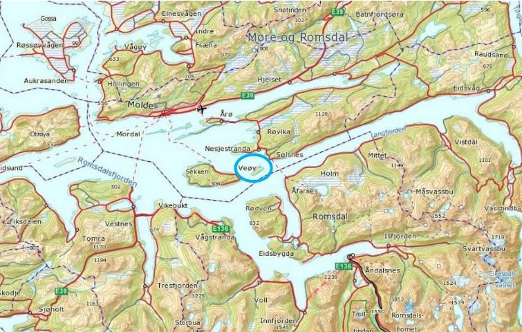
Rauma
Rauma is a municipality in Møre og Romsdal county, Norway. It is part of the traditional district of Romsdal; the administrative centre is the town of Åndalsnes. Other settlements in Rauma include the villages of Vågstranda, Måndalen, Innfjorden, Veblungsnes, Verma, Isfjorden, Eidsbygda, Rødven, Åfarnes, and Mittet. Most settlement in the municipality is located along the fjords and in the Romsdalen valley.
The municipality surrounds part of the southern end of Romsdalsfjorden and the Isfjorden and it also includes the Romsdalen valley and Romsdalsalpene mountains. In the lower part of the valleys and around Romsdal Fjord and Rødvenfjorden are driven agriculture with emphasis on livestock; the clothing industry has traditionally been a dominant industry in the municipality, especially in Isfjorden. In the summer, Rauma has a fairly large amount of tourist traffic; the top tourist attractions include mountain climbing/hiking, salmon fishing, Trollstigen, and the historic Rødven Stave Church.
The 1,502-square-kilometre (580 square miles) municipality is the 51st largest by area out of the 422 municipalities in Norway. Rauma is the 143rd most populous municipality in Norway with a population of 7,503; the municipality's population density is 5.2 inhabitants per square kilometre (13/square miles) and its population has increased by 2.4% over the last decade.
The municipality of Rauma was established on 1 January 1964 when the old municipalities of Eid (population: 381), Grytten (population: 3,683), Hen (population: 1,663), Voll (population: 1,163), and the southern part of Veøy (population: 1,400) were all merged to form one large municipality; the municipal borders have not changed since that time.
The municipality is named after the Rauma River, which flows through the Romsdalen valley.
The municipality surrounds the eastern part of Romsdal Fjord, Isfjorden, and Rødvenfjorden, and it is south of the Langfjorden, it also surrounds the Romsdalen valley and the Rauma River from the mouth to the Oppland county border.
The Kyrkjetaket and Gjuratinden mountains lie in the northeastern part of the municipality; the mountains Romsdalshornet, Store Trolltind, Trollryggen, Store Venjetinden, and the Troll Wall are all in the central part of the municipality in the Romsdalsalpene mountain range. The mountains Karitinden and Puttegga are located in the southwestern part of the municipality. Part of Reinheimen National Park lies within the municipality.
Attractions
Rauma is frequently visited by tourists, especially due to the major sights:
- Trollveggen in Romsdalen valley
- Trollstigen road to Geiranger
- Rødven Stave Church (built around the year 1200)
The Rauma is a river that runs through Romsdalen, a valley in Møre og Romsdal and Oppland counties in Norway. It runs for 68 kilometres (42 miles) from Lesjaskogsvatnet, a lake in the municipality of Lesja, to the town of Åndalsnes in the municipality of Rauma; the river was once famous for its salmon-fishing, but since an infection with Gyrodactylus salaris only 5 to 10% of the original stock survives. The salmon runs up to the Slettafossen, a 16-metre (52 ft) high combination of waterfalls and rapids more than 42 kilometres (26 miles) upriver from the estuary.
The Rauma River and its valley are regarded as one of the most beautiful in Norway; the river runs very clear with a green tint and the mountains tower some 1,500 to 1,800 metres (4,900 to 5,900 ft) above the river in the lower and middle parts of the valley. The Reinheimen National Park and the Trollveggen cliff are both located along the southwestern shores of the river through the municipality of Rauma; the Romsdalsalpene mountains surround the river and the valley, including the mountains Store Trolltind, Store Venjetinden, Trollryggen, and Romsdalshornet. The Rauma Line railroad follows the river through the valley on its way north to Åndalsnes; the railroad crosses the river on the Kylling Bridge at the village of Verma.
The Rauma was classified as a protected watercourse in 1992, and the only main tributary affected by hydroelectric power is the Verma River with the over 300-metre (980 ft) Vermafossen falls; the biggest tributaries are the Ulvåa and Istra. The Istra runs through the Ister Valley, well known for Trollstigen Road in its upper parts.
The meaning of the name Rauma is unknown (it is probably very old).
The Earl of Orkney was originally a Norse jarl ruling the Norðreyjar (the islands of Orkney and Shetland). Originally founded by Norse invaders, the status of the rulers of the Norðreyjar as Norwegian vassals was formalised in 1195. Although the Old Norse term jarl looks similar to "earl", and the jarls were succeeded by earls in the late 15th century, a Norwegian jarl is not the same thing. In the Norse context the distinction between jarls and kings did not become significant until the late 11th century and the early jarls would therefore have had considerable independence of action until that time. The position of Jarl of Orkney was eventually the most senior rank in mediaeval Norway except for the king himself.
The jarls were periodically subject to the kings of Alba (the Kingdom of Alba refers to the Kingdom of Scotland between the deaths of Donald II in 900 and of Alexander III in 1286) for those parts of their territory in what is now mainland Scotland (i.e. Caithness and Sutherland). In 1232, a Scottish dynasty descended from the Mormaers of Angus replaced the previous family descended from the late 10th century jarl Torf-Einarr, although the Norðreyjar remained formally subject to Norway. This family was in turn replaced by the descendants of the Mormaers of Strathearn and later still by the Sinclair family, during whose time Orkney and Shetland passed to Scots control.
Norse Jarls
Rognvald Eysteinsson, Earl of Møre (865 - 890) is sometimes credited with being the founder of the jarldom. By implication the Orkneyinga saga identifies him as such for he is given "dominion" over Orkney and Shetland by King Harald Finehair, although there is no concrete suggestion he ever held the title. The Heimskringla states that his brother Sigurd was the first to formally hold the title.
Sigurd's son Guthorm ruled for a year and died childless. Rognvald's son Hallad then inherited the title. However, unable to constrain Danish raids on Orkney, he gave up the earldom and returned to Norway, which "everyone thought was a huge joke". Torf-Einarr then succeeded in defeating the Danes and founded a dynasty which retained control of the islands for centuries after his death. Smyth (1984) concludes that the role of the brothers Eysteinsson lacks historical credibility and that Torf-Einarr "may be regarded as the first historical earl of Orkney".
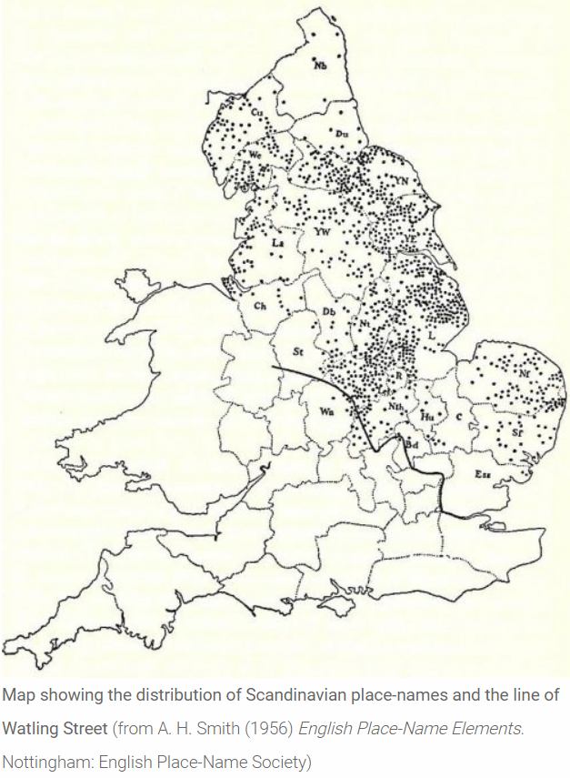
Editor's note. The reference to 'Danish raids on Orkney' is a clear indication of the mutual hostility which existed between the Norsemen and Danes, which hostility (1) would have precluded a peaceful coexistence and shared settlement under the 'Danelaw' and (2) explains why a preponderance of the personal names and place-names of the kingdom of Northumbria - formerly Deira (Yorkshire) and Bernicia, (Northumberland) - are derived from old Norse sources, there being a dearth of personal names and place-names evidencing Danish settlement north of East Anglia. This could also explain why no northern border to the Danelaw (southern boundary of the Norselaw) was described in the Treaty of Alfred and Guthrum (circa 878 A.D.) a treaty between:
""King Alfred and King Guthrum and the councillors ("witan") of all the English race and all the people which is in East Anglia. First concerning our boundaries: up on the Thames, and then up on the Lea, and along the Lea unto its source, then straight to Bedford, then up on the Ouse to Watling Street.""
This has been taken as the boundary of the Danelaw. However, the treaty does not describe it as such, and it appears to be primarily a political boundary, perhaps created in the wake of Alfred's taking of London.
"As well as being mentioned in the Anglo-Saxon Chronicle entry for 1013, Watling Street is also mentioned in the treaty terms agreed by King Alfred the Great and his recently defeated Viking rival, Guthrum, sometime before 886, at a time when the last surviving Anglo-Saxon kingdom of Wessex was struggling for its survival. This agreement acknowledged clear spheres of control between the English and Danish leaders, and secured Alfred's own kingdom of Wessex from the threat of Danish armies by recognising Guthrum's control of East Anglia. The dividing line between Alfred's and Guthrum's kingdoms was outlined in some detail:
"First concerning our boundaries: up the Thames, and then up the Lea, and along the Lea to its source, then in a straight line to Bedford, then up the Ouse to Watling Street."
"Watling Street (OE Wætlingastræt) is the name that the Anglo-Saxons gave to the road that the Romans built to connect Dover with Wroxeter. It cut a roughly diagonal line, perhaps as much as six metres wide, running from the south-east, via London and St Albans, to the north-west of the country, crossing central England."
However, there is no suggestion in this treaty that the border continued to run north and eastwards along Watling Street through the Midlands, although some historians assume that this must have been the case. Instead, it looks like Alfred and Guthrum didn't discuss the political situation in Mercia or attempt to define any boundaries there. This isn't surprising as, of course, Guthrum wasn't the only Viking leader harrying the English countryside in the ninth century, and other Viking leaders weren't bound by the treaty terms agreed with Alfred. In 893, the Anglo-Saxon Chronicle refers to various oaths and pledges given to Alfred by Northumbrians and East Anglians, as well as the activities of 'other raiding-armies'. By the time the treaty with Guthrum was agreed, it is also evident that some of the Viking armies had become a permanent fixture in northern and eastern England, with references to them dividing up the land and settling down. Mercia seems to have been divided into two halves, east and west, with the western part being left under the control of Ceolwulf, while the eastern part was settled. As a key communication route, Watling Street, would no doubt have functioned as a convenient dividing line to all parties in working out details of any agreement in Mercia."
Per Dr Kathy Holman, Associate Lecturer, The Open University, author of Watling Street, the Danelaw and the East Midlands, Part 1
See also pages 1-11 of Vikings and the Danelaw (2005) James Graham-Campbell, Richard Hall, Judith Jesch, David N Parsons
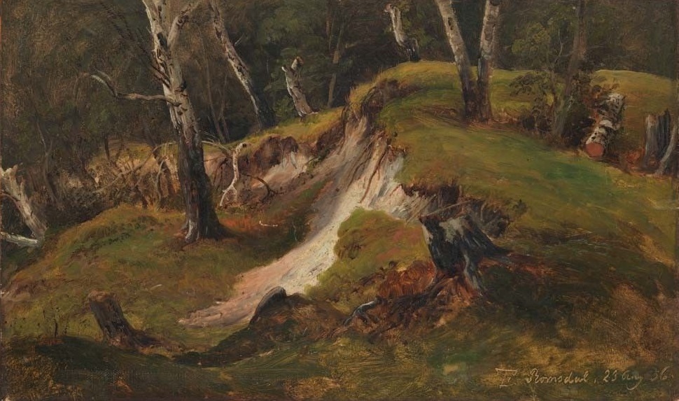
Thomas Fearnley (1836)
Escarpment Tree Stumps, Romsdal
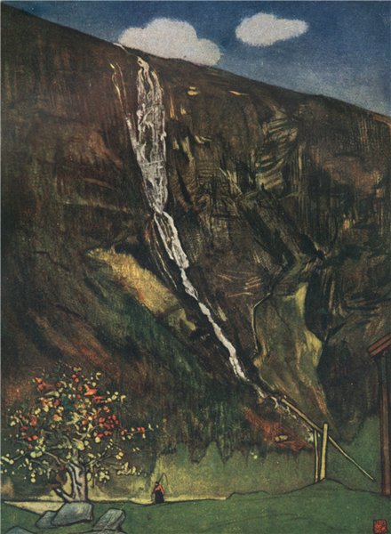
Nicolaas (Nico) Wilhelm Jungmann (1905)
"Romsdals Waterfall"
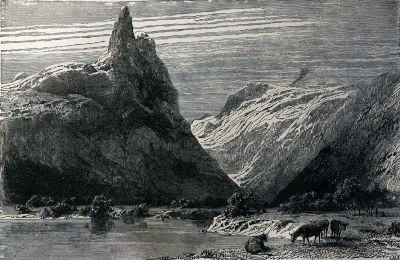
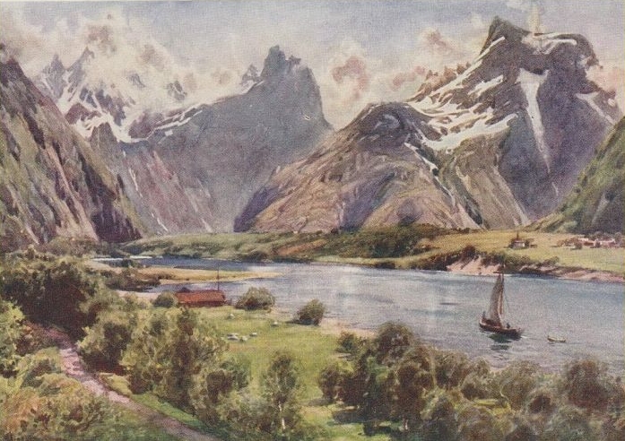
The Romsdal
 |
 |
 |
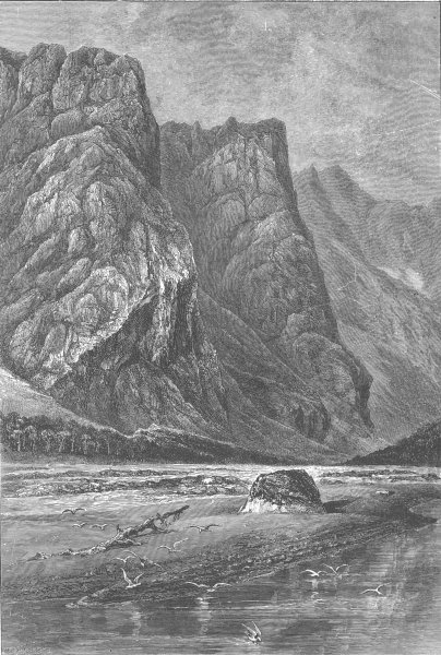
| The Romsdal near Horgheim (1890) | The Trolltinderne, Romsdal (1885) | The Romsdalhorn (1890) |
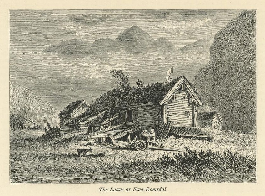
The Laave at Fiva Romsdal (1887)
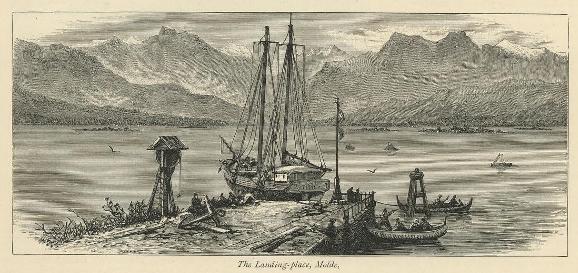
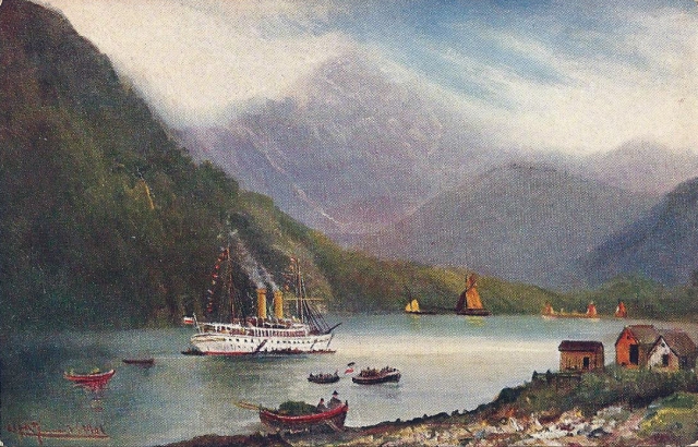
The Landing-place, Molde (1877)
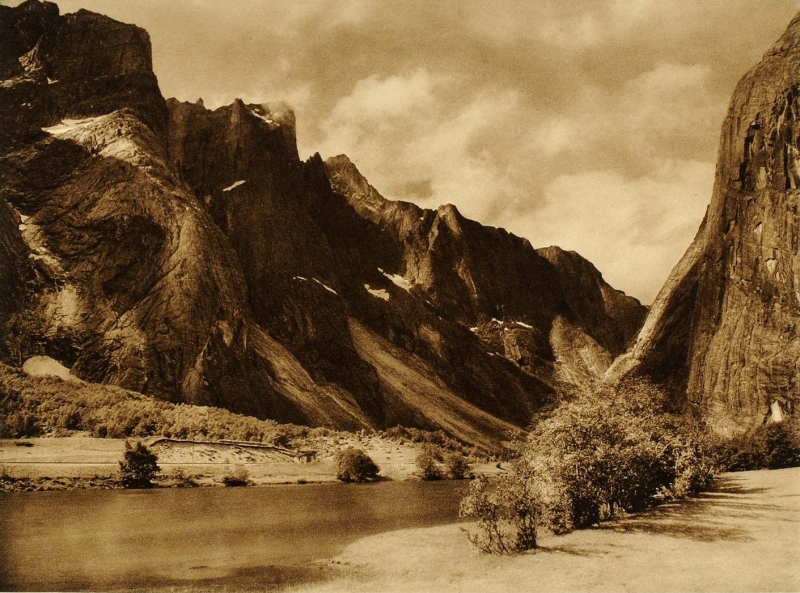
Trolltindene Romsdal Trollveggen (1932)
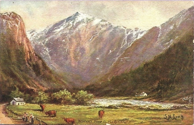
View in the Romsdal (circa 1908, artist L.M. Long)
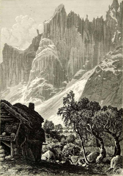
Romsdalen
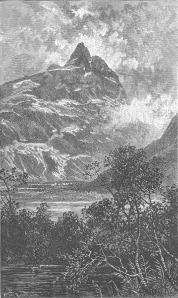
Romsdalshorn 1904
Romsdal Alps 1928
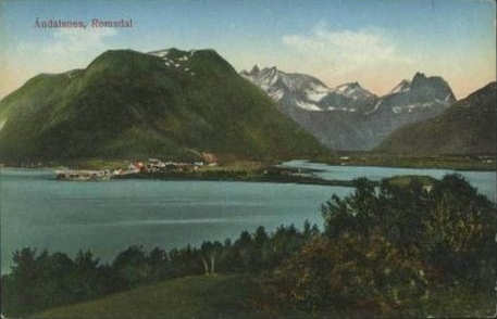
Åndalsnes, Romsdal
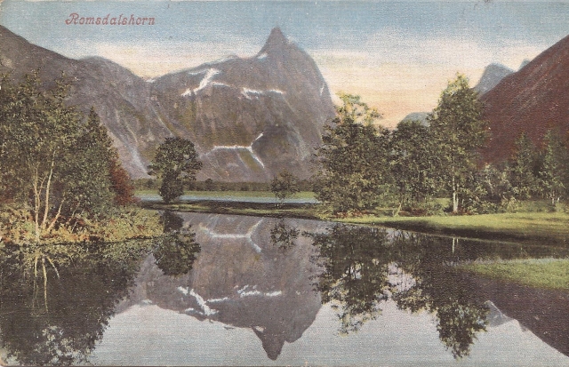
Romsdalshornet Møre og Romsdal Mountain Peak ca 1905-1914
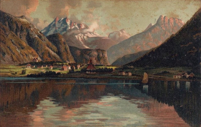
Romsdalsfjorden Møre og Romsdal ca 1905-1914